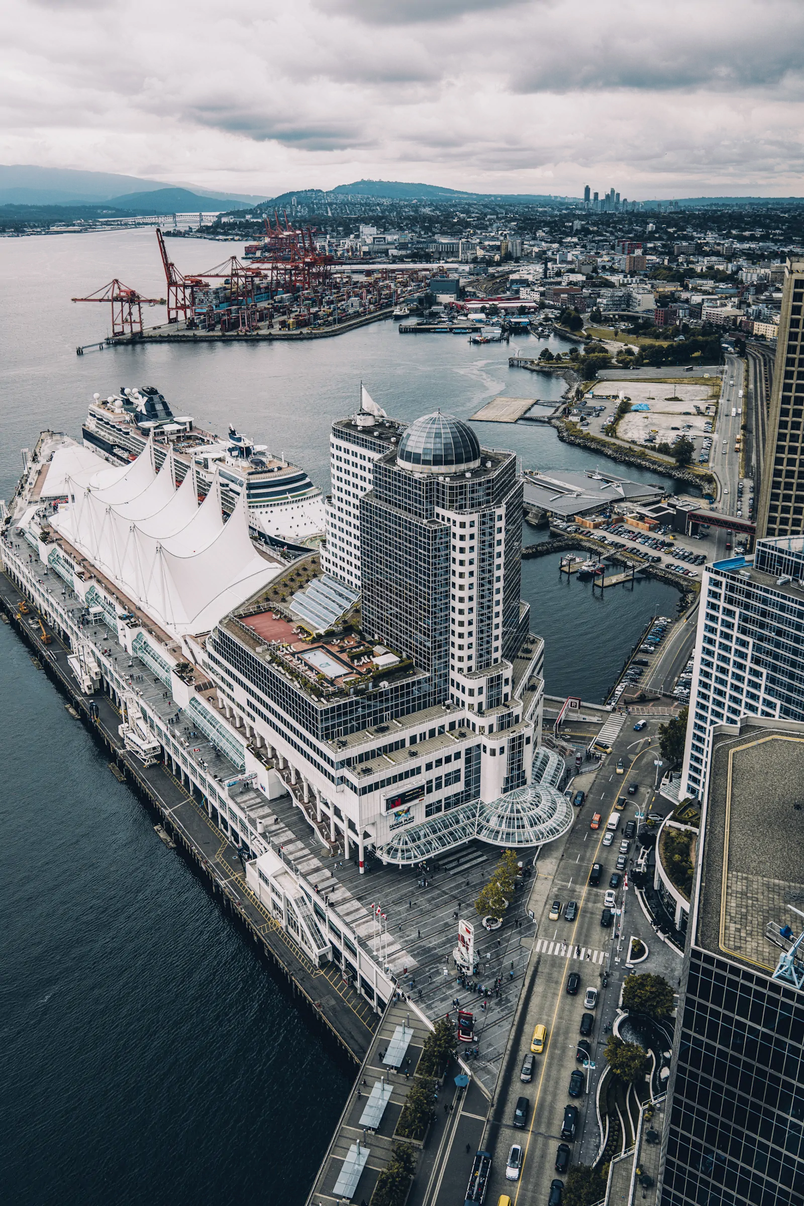
Canada Place, CRAB Park and Centerm on Vancouver's Waterfront
Canada Place, the Pan Pacific Hotel, CRAB Park and the cranes of Centerm line up along Vancouver's inner harbour in a single view. From above they read almost as one waterfront. At ground level, they are three quite different ideas about what a waterfront is for.
On the left is the waterfront built for arrival.
Canada Place occupies Canadian Pacific's old Pier B-C, where liners once carried passengers across the Pacific along with mail, freight and all the other business of an ocean port. Long-haul aviation steadily killed that version of passenger shipping. By the 1970s the pier was largely finished as a working liner terminal; a decade later it was rebuilt as the Canada Pavilion for Expo 86 and designed from the beginning to have a second life as convention space and a cruise terminal. The Pan Pacific, swimming pool and all, sits directly above it.
Farther east is the waterfront built for stuff.
Centerm began as Centennial Pier, a $5-million break-bulk terminal completed in 1958 with transit sheds, outdoor storage and four German dockside cranes. Twelve years later it acquired Vancouver's first major deep-sea container crane. A trade journal announced in 1970 that the port was finally being "lifted into the age" of container shipping by a machine as tall as a twenty-storey building.
That transition was anything but smooth. A federal transportation study in 1973 bluntly described Vancouver's fifteen-acre container operation at Centennial Pier as "wholly inadequate." The longshore union was already asking Ottawa for more container capacity, worried that Vancouver would lose traffic to American ports. The coloured steel boxes that now look inevitable were still rearranging the economics, labour and physical geography of the harbour.
And between the cruise ships and containers is the easiest piece of this photograph to overlook.
CRAB Park is the small patch of shoreline just east of the downtown rail lands. Its existence was not part of some generous master plan. Downtown Eastside residents began campaigning in 1982 for what they called a Create A Real Available Beach. When lobbying failed, supporters occupied the federal port land. At one point around sixty tents remained there for roughly seventy-five days.
They eventually won seven acres.
The park opened in 1987 on land still owned by the port and leased for public use. Even its official name took another fight: the Park Board finally changed Portside Park to CRAB Park at Portside in 2004, recognizing the campaign that had created it in the first place.
There is something useful about seeing all three from this height. At Canada Place, access to the water means arriving with luggage. At Centerm, it means controlled gates, railway tracks and cargo measured in containers. At CRAB Park, it meant convincing several levels of government that people living nearby should be allowed to walk down to the shore at all.
The beach is tiny from up here. The cranes are not.
Join the conversation